Sunken Barge In Georgian Bay

McCrae Lake lies right next to Georgian Bay, but with just enough of a rock ledge that there are (usually) no motor boats. Situated in a conservation reserve it’s devoid of cottages, and yet surrounded by a variety of the unique terrain that makes Georgian Bay such a lovely place to visit.
Picture
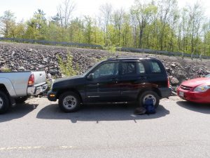
Parking

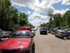
The downside are the crowds. Located just over an hour from the GTA it attracts huge numbers of weekenders. The access road is often so packed that it’s hard to find a parking spot. Finding a campsite can be almost impossible, and when you do there’s a good chance that it’s been trashed. Still, it’s such a beautiful spot that I’ve returned several times for day trips.

This was my first visit to McCrae, and the lake wasn’t even my goal. I wanted to find the “Sunken Barge” geocache on Georgian Bay.  The description didn’t mention where we should put in, so I checked my copy of Kevin Callan’s “A Paddler’s Guide To Cottage Country” and he had a route from McCrae lake up to the cache.

McDonald Lake

After a short portage down from the parking area we put in on McDonald Lake. McDonald is really a small beaver pond. Even though it has a view of cars whizzing by on the highway it’s a beautiful spot in its own right. The pond weaves back and forth, to the portage. Apparently at times a lift-over may be required to get to the portage, but I’ve never encountered it.

The portage is a huge rock shelf that creates a small waterfall where the pond empties into McCrae Lake. An ATV bridge has been built over the falls, and while it is ugly, it does provide a vantage point from which to take photos.

On our first visit some campers were stationed almost at the base of the portage. They had a huge tent and cases of beer. Rather then carry all of their gear over the portage they just camped right there. I’ve seen people coming out of McCrae with lots of questionable camping gear including lawn chairs, coolers, and even chainsaws. It may be a conservation reserve, but it sure isn’t very well protected.

We found our first geocache of the day, “McCraezy Falls” along the portage. The portage itself isn’t particularly difficult, even if it is a bit steep at each end. The far end of the portage is a lovely sandy beach at the base of the falls. We were carrying the boat over our heads and I couldn’t see much when all of a sudden I spotted a naked woman! I did a double take and realized that she was enjoying the rapids in a flesh coloured bikini.

McCrae Lake

After the beach McCrae feels more like a creek than a lake, and it winds back and forth between boggy areas. There are some beaver lodges here. It’s a nice area, but it pales in comparison to what you’ll soon encounter. When you turn the last corner the lake opens up ahead. Twisted rock formations on either side frame a small rocky island. At sunset the light will catch these rocks and make them glow with a red light. It’s a really pretty spot.

It’s not a very large lake, but it’s spidery, with several bays, so navigation can be a bit tricky. There’s a large island in the middle of the lake, and in the far end of this bay are some cliffs that are popular with rock climbers.

We didn’t visit those cliffs on this trip, because we were pushing on to our destination geocache. We crossed the lake to where a small rock ledge separates McCrae from Georgian Bay. The lake tumbles over the rocks and forms a small rapid. Scenic cliffs tower on either side. It’s a really pretty spot, and the far side is a popular anchorage for cottagers on the bay who visit the area for picnics. There’s another geocache hidden here, “McCraezy on the Bay” at the top of one of the cliffs next to a lovely campsite.

In addition to the geocache there are two shrines located here. One is a small altar built into the cliff, and the second huge cross mounted high up on the same side and visible from the bay.

Georgian Bay

The next part of our trip was a very long paddle up the bay to the mouth of the Gibson River. I must say I can’t really recommend this part of the trip. Don’t get me wrong, the scenery is still amazing, but the shore is littered with cottages, and after the serenity of McCrae Lake it was kind of disappointing to struggle to paddle through waters infested with motor boats.

It took us a long time to reach the river. When we did, not only did the water calm down, there were far fewer boats and no cottages. We didn’t have long to travel up the river before we reached our destination — an old sunken logging barge. The geocache had been hidden underwater in the ruins of the barge. We found the cache and retraced our steps.

Even though the paddle through cottage country was far from being a highlight of the trip exploring the old barge was pretty neat.

Conclusion

We made it back to McCrae Lake just in time to catch the sunset. It’s a pretty spectacular place to be during the golden hour. The water of the lake was calm and we paddled slowly back to the portage as we took in the scenery. We had to tie the canoe to the car in the dark, and then we took a short hike to find one last geocache, “Not Going McCraezy”.

Tips

McCrae Lake is spectacular, but I don’t know how much I’d recommend it as a camping destination. The crowds and the mess are rather unappealing. I tried to camp at McCrae once, but was advised in the parking lot that all of the good sites were taken so I went elsewhere. If you do decide to camp at McCrae I’d forgo the trip through cottage country as I felt it detracted from the experience.

Difficulty

  • This is a very easy trip. The only portage is along a well worn easy to follow trail, but the rocks can get slippery in the rain.
  • This trip can easily be done in one day, so it makes for a very easy two day camping trip.

Remoteness

  • McCrae Lake is a spectacular gem. It would be unspoiled were it not for the crowds. But the crowds are pretty bad.
  • Even though this is an ideal two day trip I wouldn’t recommend it on a weekend. Most of the sites will be taken early on Friday. If you do want to go on a weekend it’s best to start your trip early.
  • There are far less crowds in the early spring and the fall. I’ve been here on day trips in the shoulder season and it was the only time that camping seemed possible.

McCrae Lake Bushwhack

My next destination was the rapids where McCrae Lake dumps into Georgian Bay. This is a much easier destination for a paddle than a hike, but it was a nice day on the trail. Once I left the crowds at the cliff I didn’t see anyone else until I got to the rapids. I was moving pretty quickly so as not to give the bugs a chance to find me, but I did take a break to enjoy the view and catch my breath at the heron rookery. I was worried that I’d scared her away from her nest, so I was glad to see that she was back when I returned.

Shoulda Brought The Focus…

After two weeks of rain we finally had a nice weekend forecast. I had been planning to go camping, but those plans fell through when my paddling partner bailed on me. There were two new caches at McCrae Lake that were still unfound so I had a new destination for a hike instead of a paddle. But the new caches weren’t really my target. There’s a cache nearby on Bears Head Lake that’s pretty much in the middle of nowhere. There was no obvious way to get there other than to bushwhack through the woods.

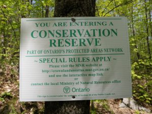
Conservation Reserve

McCrae Lake is always popular, and the sunny weather had brought out droves of people. Parking my car in the only tight spot I could find was almost harder than the first part of my hike.

The Trail

There’s a hiking trail around McCrae Lake that leads to the cliffs at the west end of the lake. The cliffs are a popular destination for climbers and were where the first cache “It’s A Cliffhanger” was hidden. I met lots of climbers at the clifftop. When I finally stopped enjoying the view, found the cache, and opened the log I discovered that I’d missed the FTF by just over an hour! The trail was indeed crawling with geocachers.

My next destination was the rapids where McCrae Lake dumps into Georgian Bay. This is a much easier destination for a paddle than a hike, but it was a nice day on the trail. Once I left the crowds at the cliff I didn’t see anyone else until I got to the rapids. I was moving pretty quickly so as not to give the bugs a chance to find me, but I did take a break to enjoy the view and catch my breath at the heron rookery. I was worried that I’d scared her away from her nest, so I was glad to see that she was back when I returned.

The trail is sparsely marked in places. I actually prefer that to an over marked trail, but I did lose it a few times as I got near the next new cache, “Chuck And Kevin Get A Little Erratic”. Once I almost wandered into a campers back yard. Whoops. When I finally found the cache I saw that I was just half an hour behind a different cacher on this one, and another group was just fifteen minutes behind me!

I lost the trail again and ended up bushwhacking to the rapids. I walked right past the large cross on the hill, and had an interesting descent. I stopped on the rocks overlooking the rapids to cook myself a burger for lunch. In retrospect bringing the stove and burgers for lunch was probably overkill, but it did make for a hearty snack before attempting my destination cache for the day, “Bears Head”.

The Bushwhack

Since I was going to be bushwhacking I needed to do some planning before I set out. I didn’t have a trail map so I didn’t know exactly where the hiking trail was, but by studying the satellite photos before I set out I was able to design a trail that I thought would connect with it. My biggest worry was getting trapped behind a marsh or bog that would be too difficult to cross, so I drew a line on the map that followed the rocky outcrops as much as possible. I also downloaded the satellite photos to my Oregon so I could see where I was as I walked in case I ran into some difficulties.

After all that planning I almost didn’t make the attempt. When I got to my lunch spot I examined my track and saw where the trail would cross my planned bushwhack. The distance would be about 2 kms one way, as the crow flies, and it was getting late in the day. I decided that if I could get to the start of the bushwhack by 5:30 I’d make the attempt.

I got there with 5 minutes to spare, so I decided to go for it. The vegetation is fairly sparse, and I was able to make reasonable progress. It was a little tricky to stick to the line that I’d drawn on the map, and following the contours of the land was quite exhausting because there was much more up and down than on the marked trail. I knew my plan was working when I got to one of the turns in my planned track and saw that I had just avoided a large bog.

It wasn’t all roses however. I was 340m from the cache when I came to a wet soggy area that I had to cross. Despite some hummock hoping I got double soakers. Still, it was a lot better than crossing the marsh right next to the lake. I don’t know if it’s a common occurrence, or a result of all the recent rain, but the marsh is overflowing into the lake and washing a swath of vegetation off the rocks between the two.

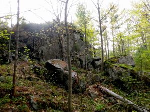
Rocks
Rocks

As soon as I stopped moving the skeeters swarmed me, and I had to look for the cache quickly. Fortunately it was a very easy find. Bears Head lake is quite pretty, but the bugs and the time of day mean that I signed the log quickly and ran. I was quite surprised to see two parallel tracks worn into the moss on the rocks near the cache. Obviously there’s a way to get an ATV in here, and it was quite surprising to find out that this was a ‘roadside’ cache. The only other things that broke the spell of being isolated in the bush were the sounds of boats nearby on Georgian Bay, and a lone piece of flagging tape I spotted while deep in the bush.

Getting back to the trail was a little easier than getting to the cache. In the end it was a 5k bushwhack and took an hour and forty minutes. After that it took another hour and a half walking on the trail to make it back to my car just 15 minutes before sunset. I stopped at the top of the cliff on my way out to catch my breath and enjoy the view.

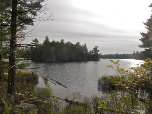
Bearshead Lake
Bearshead Lake

Tips

Like my other trips to McCrae Lake my geocaching may have led me astray. The bushwhack to the cache was the least scenic and most difficult part of my trip. So unless you intend to find the cache I wouldn’t recommend it. But I’m still pretty glad that I went :-). If you want to camp at McCrae Lake you’ll find it far easier to canoe in than to hike, but hiking is a possibility as there are a few campsites not far from the trail.