
The Blue Ridge section of the LaCloche hills isn’t home to the tallest peak in Killarney. That honour is reserved for Silver Peak where the north and south ranges intersect. But the peak of Blue Ridge that looms on the north shore of OSA Lake is only fifty meters below Silver Peak, and a strong contender for the second highest point in the park. It’s hard to tell for sure which peak is the second highest since the peak of Blue Ridge isn’t even identified on most maps, but it has two chief advantages for the backcountry adventurer over the more famous mountain to the north. First, there’s no trail leading up to the top so there are fewer crowds, and second, it can be accessed more easily in the winter.
The first time I visited OSA Lake I climbed a cliff on the north shore to find a geocache. Bushwhacking up the ridge to a point high above the pretty lake was an amazing experience, and I’ve returned to the same spot twice now. But even on that first visit I turned around and saw that I was only at the foot of a much larger hill. I longed to climb it then, but I didn’t have the time. I figured the only way to climb it in the winter would be to camp overnight on OSA Lake, and I’m not yet up to winter camping. But while planning a snowshoe trip to ‘The Crack’ I realized that it would be possible to make the trip by crossing Killarney Lake when it’s frozen. Plans of visiting ‘The Crack’ were abandoned in favour of the more remote destination.
The Trail
The drive from Southern Ontario requires an early start, and we didn’t get to the trailhead until 11AM. The weather wasn’t as ideal as it has been on our previous snowshoe trips in Killarney. While it wasn’t particularly cold the sky was mostly grey, with very occasional patches of blue visible. The sky remained bleak for most of the day, and the lack of light meant that many of the photos we took looked like they were shot in black and white.
The first part of the trail was surprisingly well travelled, and so well packed down that snowshoes weren’t really required. It was no harder than walking on an easy gravel path. It didn’t take long to heat up on this kind of trail and I was soon peeling layers off as I started to sweat. I’ve never used this access point before, and was surprised by the terrain. It’s pretty, but relatively flat, and has none of the spectacular hills or rocks that Killarney is famous for.
The Portage
We left the well travelled trail when we got to Kakakise Lake. The previous hikers had continued on up to ‘The Crack’, and there was only a hint of old tracks that crossed the portage trail to Killarney Lake so we were essentially breaking fresh snow. I’ve walked the Kakakise to Killarney portage in the summer, and it’s not an easy trail. Both ends head almost straight up, and the space between continues to rise towards the peak in the centre. In the summer the large rocks that litter the trail make footing difficult. The snow actually made things easier by evening out the poor footing. The only incident on the portage was that we lost the trail at one point and I ended up on the wrong side of the creek. When we crossed back over I broke through the ice and had a heavy foot until my shoe dried off.
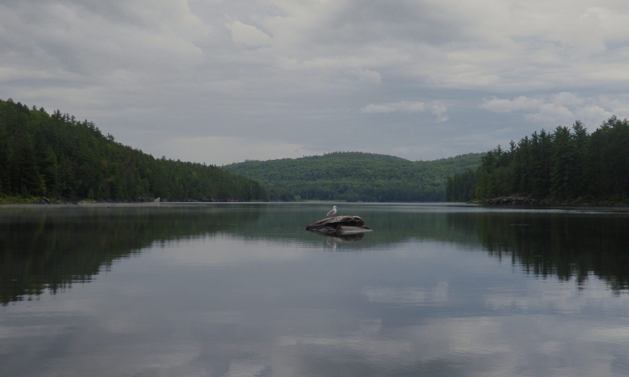
Killarney Lake
Killarney Lake is a spectacular spot summer or winter. When canoeing from Freeland Lake the channel winds back and forth, and each bend reveals another beautiful mountain. It makes for an impressive introduction to the parks interior, so I was pretty excited about hiking through it in the winter. We had a snack and enjoyed a brief break in the clouds to take in the view before setting across the ice. I thought that one of the hills in the distance was our destination, but it turns out that our goal was blocked behind some trees and I was looking at a much smaller hill.
The wind really gets moving on the lake, and it had blown all of the powder away and polished the snow to a thin hard crust. This made walking easier, almost like asphalt, but out in the open on the ice the wind was cold. We put all the layers we’d taken off back on, cinched our hoods tight to protect our ears, and still the wind cut through and gave us a chill. Every few minutes a particularly strong gust would sweep a swirling cloud of snow off the ice and whip it past us.
We cut across some of the spits of land that frame the channel to shorten our walk, so we had to cross two separate stretches of ice. The whole way we could see our destination. The perspective was tricky and at times it seemed to get smaller, and then it would loom larger than ever. I had to remind myself that even though we’d be starting our climb from Killarney Lake the mountain was actually perched on the shore of OSA Lake so it was further than it seemed.
The Climb
The wind stopped a few meters from shore, but along with the shelter from the breeze came deeper snow that was much harder to navigate. I fit my new tails on my snowshoes, but even with the extra flotation it was much harder to break trail in the bush. I had plotted a path up the hill on a topo map, and as we crossed the lake I was surveying it to get a feel for the landmarks. The hills of Killarney are relatively easy to climb, but there are some steep cliffs, and without some planning you can back yourself into a corner or tackle a very steep slope when there’s an easier one nearby.
The plan was to climb a valley carved by the runoff between our target hill and the smaller mound to the northeast. I was surprised by how steep our ascent was, even though we were taking the ‘easy’ path. The trees were thick enough that we couldn’t see very far so the only way I had to gauge our position was the slope of the land and the GPSr. We finally came to a fairly steep drop off and I realized that we’d been climbing to the right of the creek that carved the valley. The resolution of the maps is limited, and often smaller features dominate the landscape and make it hard to figure out where you are.
We were still close enough to our intended path that it made sense to continue, but I decided to modify our route slightly. Originally I had intended to circumnavigate two round pillars of rock on the front face of the mountain, but from where we were standing that looked a bit precarious so I decided to go between them instead. This decision soon put us in an awkward spot, as after we rounded the gap between the peaks we started to see a white wall ahead of us. By changing our route I’d shortened our trip slightly, but I’d also led us to the base of a 50 meter cliff!
The ridge at the top of the cliff was sloped, so we headed in a direction that brought us closer to the top, but eventually we had to climb almost straight up. Normally Mike leads when go the hard way up hills, but I was breaking trail at the time so I just started zigzagging back and forth to cut stairs into the nearly vertical wall of snow. We were only 500 meters from the peak, but our progress slowed to a crawl since I could only take a few steps before needing a break. In the next half an hour we only moved 300 meters horizontally, but we climbed almost 70 meters vertically.
The steep section was broken into several slopes with only a brief break in-between. When we finally got off the steep part of the climb the hill rounded out and was covered with a thick carpet of small twisted trees. Other than a few tantalizing glimpses of the horizon the much larger trees below had blocked most of our view on the way up, and I was beginning to worry that we wouldn’t get a view from the peak either. The hill was so round that it was hard to even tell where uphill was at this point.
The Peak
Using the GPSr I headed off in the general direction of the peak. We were finally rewarded by a small clearing that opened up enough to let us see Killarney Lake far below. Thinking this was the only view we’d get I started to snap a few pictures when I noticed another opening to the south. I followed a path through the trees and the vista opened up to reveal OSA Lake. We could see ghostly snow squalls dotted across the landscape we had crossed earlier in the day, and occasional bright spots of light out on Georgian Bay. On the far shore of OSA was Gulch Hill that we’d climbed a month ago.
The only time the clouds broke the sun shone directly on us instead of on the landscape below, so everything was painted in shades of grey. Even without light OSA Lake is beautiful, and the clouds of snow creeping across the hills below and beams of light shining onto Georgian Bay gave an impressive sense of scale to the terrain. Even though there wasn’t a bit of colour visible the scene was a fitting reward for our work.
We lingered for a while before moving on. I was worried that this would be the best view we’d get and didn’t want to leave too soon. But we weren’t at the peak yet, and even if it didn’t have a view it was the obvious destination. We headed back into the thick stunted trees and soon saw one last mound of rock rising bare above everything else.
It took some more zigzagging to start climbing this rock, and then we had a straight path across polished snow to the summit. But as each step offered more of a view it also exposed us to more wind, and for the first time of the day I really started to feel the cold. When we finally reached the small cairn of rocks at the top I was rewarded by the 360° view I’d been hoping for. The view of OSA to the south wasn’t as nice as it had been at the more sheltered lookout below us, but we could now look north and see Threenarrows Lake and the North LaCloche hills in the distance. The visibility was limited by white clouds of snow, and both Grace Lake and Silver Peak were hidden.
Our fingers quickly grew sore as we took pictures in the cold. My frozen hair cracked as I pulled my hood up before posing for a photo with the centre of Killarney in the background. I don’t look very happy in that picture, but it was a pretty great moment. We couldn’t take the wind for long however, so we didn’t linger before heading back the way we came. It only took a few minutes of walking once we were out of the wind to shake off the chill and warm our aching fingers.
Descent
Coming down the hill was a lot easier than going up had been. Not only was gravity on our side this time, we were able to follow the trail we broke on the way up. Walking backwards through the footprints we’d left earlier was still challenging because our stride was now shorter since we had less energy, and there were places where we’d stepped up over tall rocks on the way in that required a different strategy to climb down. When we came to the really steep section down the cliff I had a tough time turning around where our trail switched back and forth when my long shoes got caught in the ruts carved in the deep snow. Mike took the lead and commented that he could tell who had been breaking trail on the way in because of how naturally the footprints fit his stride.
My hips had started to twinge as we crossed Killarney Lake and had been bothering me on and off through the afternoon, but as we proceeded down the hill they settled into a constant dull ache. I kept thinking we were near the bottom of the hill only to catch a glimpse of the lake between the trees and realize that we still had a long way to go.
Return
I was pretty relieved when we made it back down to the ice. Our footprints had been swept away while were up on the peak, but the wind had died down so we had a an easy walk back to the portage even if it was a bit painful. The clouds were parting as the sun set and we could look back at the hill we’d just climbed lit up by the late evening glow.
As we neared the portage trail we could see it heading almost straight uphill between the trees. I had been dreading this last bit of hill climbing, but it was bearable as long as I kept my pace slow and took the occasional break to dull the throbbing in my hips. The sun set while we crossed the portage but the sky was still blue for about half an hour, and then the full moon rose to light our way as we walked down the last easy trail to the car.
Conclusion
Coming down off of a mountain is always anticlimactic, particularly when it’s followed by a long drive and you’re both tired. While the weather wasn’t as ideal as we could have hoped for the grey skies and muted colours had a bleak beauty of their own, and watching snow squalls clouding the distant hills provided a yardstick to measure the landscape. Killarney is always beautiful, and well worth the trip.
Tips
- If you do this as a day trip you’ll have to purchase a day pass from the park office for parking your vehicle. In the winter you can park at the trailhead for access to ‘The Crack’. In the summer you’ll have to put in at George Lake and cross Freeland Lake to get to Killarney Lake.
- If you make the trip part of a backcountry camping excursion to Killarney Lake you’ll have to book far in advance unless you go in the shoulder seasons. Killarney is one of the busiest lakes in the park.
- If you do the trip in the winter you can rent snowshoes from The Friends Of Killarney Park at the camp office where you pick up your permit.
- This trip is an excellent (and challenging) snowshoe trip, but it would also make a great day excursion while camped on Killarney or OSA Lakes. It would also be possible to do it as a day trip in the summer by canoeing from George Lake to Killarney Lake, but you’d have to get up early to do so.