
Story
Muskoka is known for rugged beauty, but not particularly for unspoiled wilderness. There are a few lakes whose shores aren’t encrusted with cottages and constantly patrolled by buzzing motorboats however. One of the largest such areas is along the course of the Gibson River.
I invited some co-workers to come for a late September canoe trip in order to find some Geocaches. Planning isn’t my strong suit, and late September turned into mid October before we headed out.
There were four of us, and the usual complexities coordinating a group of people landed us on a date with a less than stellar weather forecast, calling for 10 – 20mm of rain. Hours before our departure Environment Canada posted an extreme weather advisory calling for 45 – 50mm of rain. Oddly enough the forecast continued to predict only 10 – 20mm. The temperature was warm, the winds low, and the plans made, so we decided to press on despite the alert. The rain proved annoying, but not extreme.
I thought that the rain would mean that we were the only paddlers on the water, but we saw a lone kayaker putting in at the marina and we encountered a large group of 10 – 12 canoes paddling out on Nine Mile Lake. They had been camping on Turtle Lake since Friday night. They must have had a very cold and wet trip. Nine Mile Lake was the only part of our trip where we saw cottages, and the portage to Turtle Lake is just around the bend from the last of the houses. Once we got off of Nine Mile Lake we were completely alone, and the only sound of civilization was a train (the tracks cut right through the area we were paddling, but we didn’t make it far enough to see them). There were some boats stashed at the end of the Turtle Lake portage, but other than the blazed trails themselves and the occasional campsite the illusion of being deep in the backcountry was perfect.
The portage was a bit wet. In fact there was a waterfall right down the middle of the trail! The portage only went as far as the marsh on the maps, and I’d hoped we’d be able to paddle the bulk of it, but the marsh was far too dry so we had to do a 500m carry. There were several large (and cold) puddles on the trail that could be avoided with some extra effort, but I was already so wet I finally just decided to walk through them. Other than the water the portage was quite easy, but the trail isn’t as wide and worn as one you’d find in a large well maintained park like Killarney.
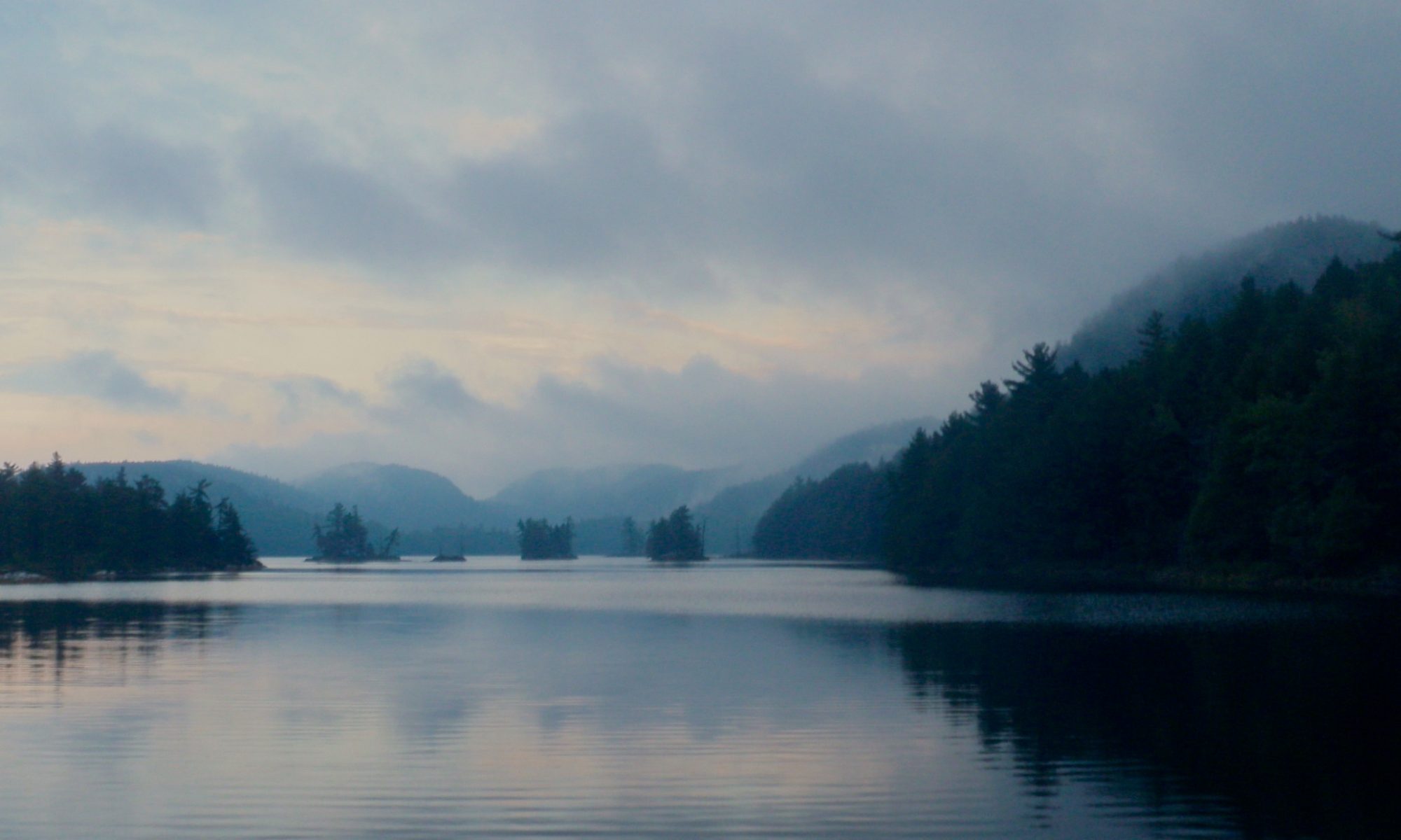
All of the lakes were well sheltered from the wind, if not the rain, and the paddle down Turtle Lake was easy. Turtle Lake is a good example of Canadian shield terrain, but not particularly remarkable in any way until you reach the south end. There it hooks West as it funnels between rock faces on both sides. There are a lot of standing dead trees in the water here, but the water is quite deep so it’s fairly easy to paddle between them. It’s a scenic little channel. There were a couple of places where I wasn’t sure where to turn, but we found the right path without much difficulty.
The beaver dam at the end of the channel isn’t particularly long, but it’s height is quite impressive. It’s constructed as a pair of arches braced against a small rock island in the middle to hold back the large volume of water.. The water on the upstream side of the dam is quite deep and was noticeably colder than in other parts of the lake. There must be several generations of beaver families who’ve worked on this dam. Unfortunately I didn’t manage to get a picture that shows off the height of the structure.
The remaining distance to Brotherson’s Lake is a short 200m portage, but just like the water it drops quite abruptly at the end. The shore of Brotherson’s Lake is ringed by small cliffs because it’s so much lower than the surrounding terrain. It makes the lake a little more scenic than Turtle Lake on the other side of the hill.
After a short paddle on Brotherson’s Lake we came to the channel that connects it to Narrow Lake. The channel was navigable without having to line the canoe, but just. Most of the channel is a mud flat covered by a few inches of water, but the current has carved a deeper passage that winds through the middle. The deeper channel is actually visible on the Bing Maps satellite photos (a cloud obscures the channel with the current Google Maps imagery). On our way into Narrow Lake it was pretty easy to see the deeper channel from the stern, but on the way out the rain had started again and covered the surface of the water with ripples which made navigation more difficult.
Our final destination was Narrow Lake, and we were only out for a day trip, so once there we turned around and headed back. We switched up the portaging duties on the way out, and also let some of the other members in our group try paddling from the stern. We made it back to the marina just after dark, but we had cleared all of the portages by the time the sun set.
Tips
There’s pay parking and free parking at the marina. Your choice pending availability.
Other than the remoteness this is a fairly easy trip. There are many other trips that can be had in the area, and being a little more wild than a developed park it’s fun to explore. Just make sure that you’re prepared with a good map and leave yourself some extra time since the trails aren’t rigorously maintained.
If you intend to camp we did see several posted sites with fire pits but I have no idea if they also have thunder boxes, or if they are maintained at all. Of greater importance I have no idea how busy they get, so I don’t know how hard it would be to find a site in high season.